
When I ask for recommendations for the top hiking destinations in Asia, responses tend to be similar. The list usually includes Mount Fuji or the Japanese Alps, Everest and Annapurna in Nepal, Mount Kinabalu in Borneo, and occasionally the nod to head to Kyrgyzstan.
For some reason, Taiwan never seems to come up. A recent month-long jaunt across its highest mountains convinced me that not only might it be one of the best Asian trekking spots, but one of the best in the world.
While mountain aficionados probably have heard of Yushan, better known to foreigners as Jade Mountain, it’s just the proverbial tip of the iceberg. Yushan is 12,967 feet, making it the highest peak in the country as well as the highest point anywhere in the western Pacific outside of Russia’s Kamchatka Peninsula. Yet while it is higher than Japan’s Fuji (12,388 feet), perhaps what is even more impressive is what surrounds it.
Taiwan has the greatest density and number of high mountains anywhere in the world. The island nation is only 245 miles long and 90 miles wide, but sandwiched between the coasts are 268 mountain peaks that are higher than 3000 meters (9800 feet). These are mostly “new” mountains, caused by the collision of the Eurasian and Philippine tectonic sea plates, which meet below Taiwan and press into each other, thrusting the land ever upward.
Much of the country is covered by subtropical evergreen forests, with temperate and alpine zones rising above these. Twenty percent of Taiwan’s land mass is under government protection, and there is an incredible array of trails, mountain huts, and signed routes across the country. It’s possible to pretty much be on any trail in the country within half a day of leaving Taipei. All these things combine to create a population of enthusiastic hiking lovers and an adventure lover’s paradise.
My wife and I started our journey off with some warmup day hiking outside of Taipei. We opted to take on half of the Yangmingshan National Park cross-park hike, which goes over ten summits across 25 kilometres of gorgeous national parkland, especially wonderful in the autumn, when the Chinese silver grass plants that dominate the mountain slopes all turn golden yellow and create a magical contrast with the verdant hills and peaks.
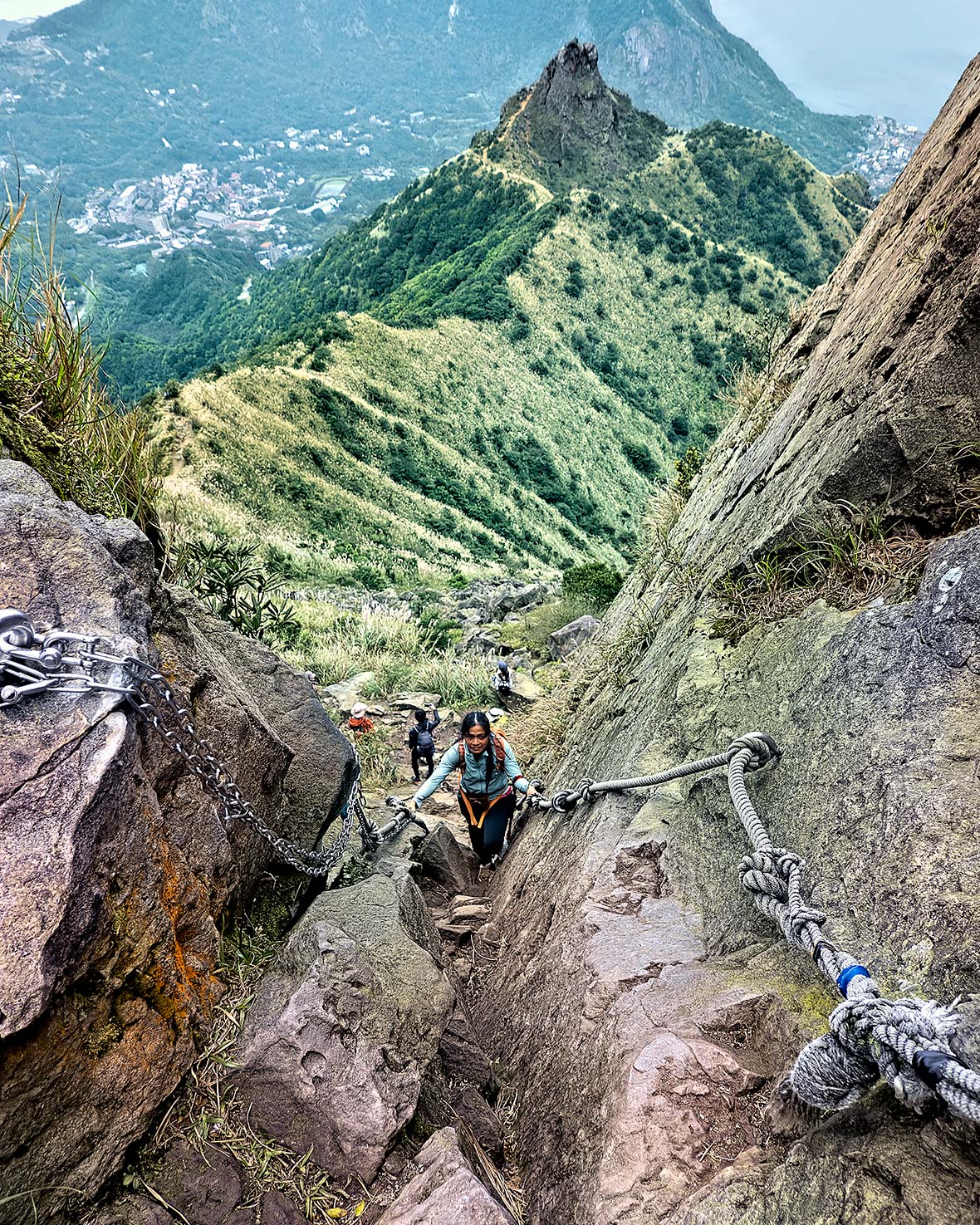
As we started our ascent of Mount Datun, we were introduced to Taiwan’s unique trail topography. Climbs here are steep, punishing, often muddy, and through dense forests full of roots and eroded slopes. Yet the various trail associations and national parks do an amazing job of trail maintenance, putting up ropes and hand lines through precarious passages.
We met a young woman hiking by herself up on one of Datun’s several peaks, and struck up a conversation, asking her about the baiyue, a bucket list of 100 top peaks chosen for their prominence, uniqueness, beauty, and danger, of which peak bagging has become an almost religious ritual for all local mountain lovers.
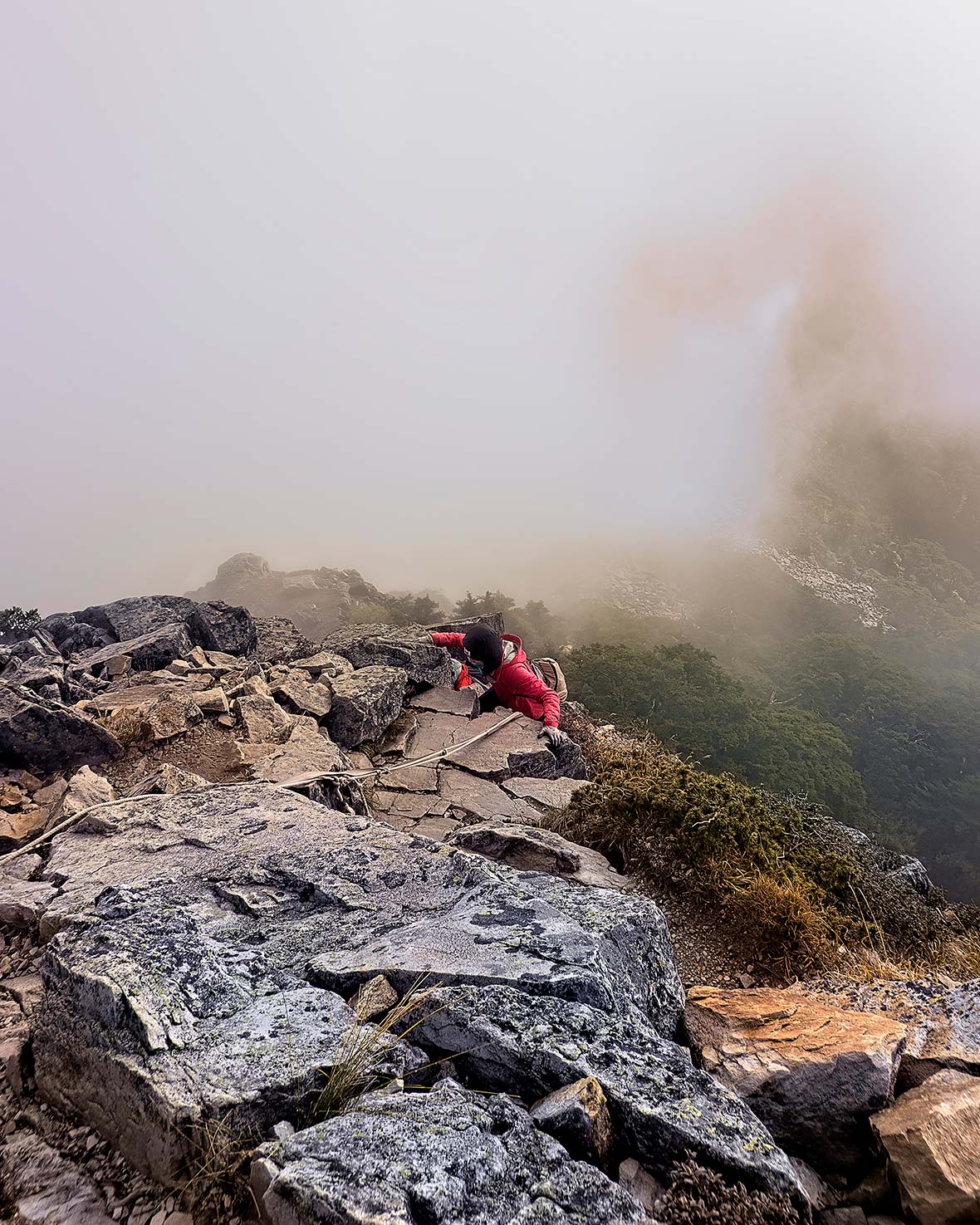
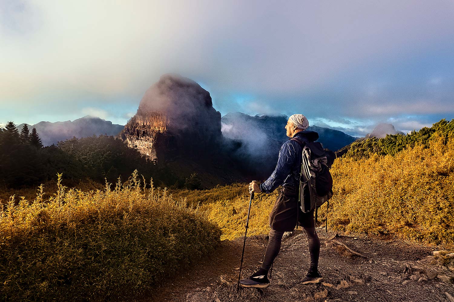
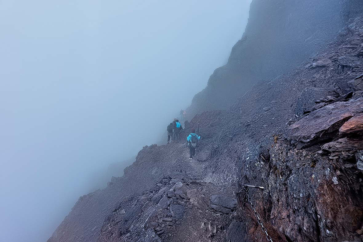
While Taiwan summits don’t require ice ascents (outside of a few peaks in the dead of winter) nor the ability to lead technical rock pitches, they have plenty of fear-inducing spots that aren’t without risk. Ropes get fixed up unstable rock gullies, which we soon discovered on the popular Teapot Mountain, also near Taipei, and then a week later on the summit pyramid of Xiaobajian in Shei-Pa National Park.
While the ropes made it possible to haul oneself up a few vertical rock steps with less fear of falling, none were necessarily secure. They’d sat out in the weather for ages (some more than others), and there were often several strands of different ropes, with no guarantees that any were certifiably fit.
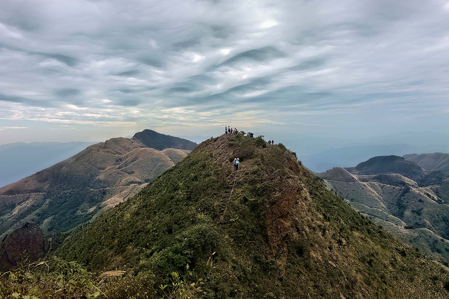
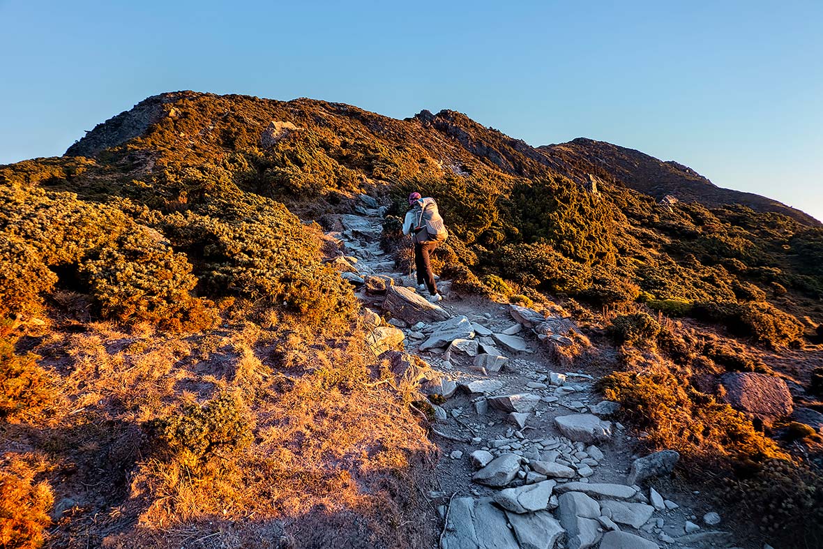
Once up high in Taiwan, routes run along ridgelines, with ascents and descents over crumbling rocky peaks covered in bamboo plants or wet grass often the norm. The baiyue are further divided into sublists which contain names like “the harsh ten,” “the four obstacles,” and “the ogre,” painting a pretty accurate picture of just what one might be up against here.
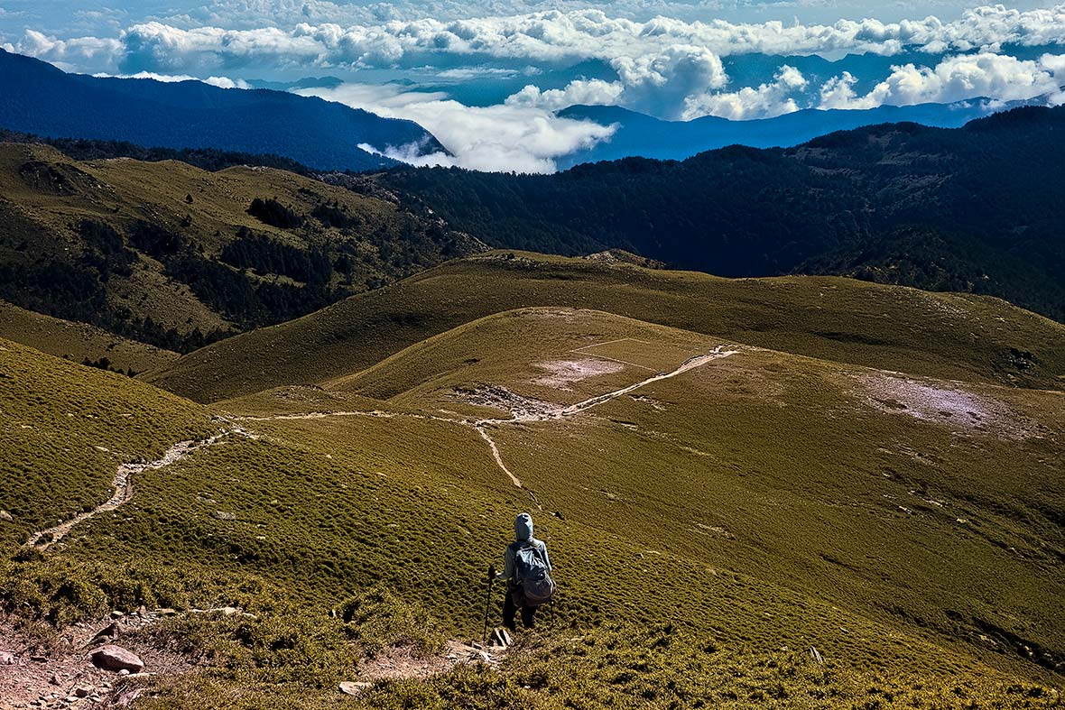
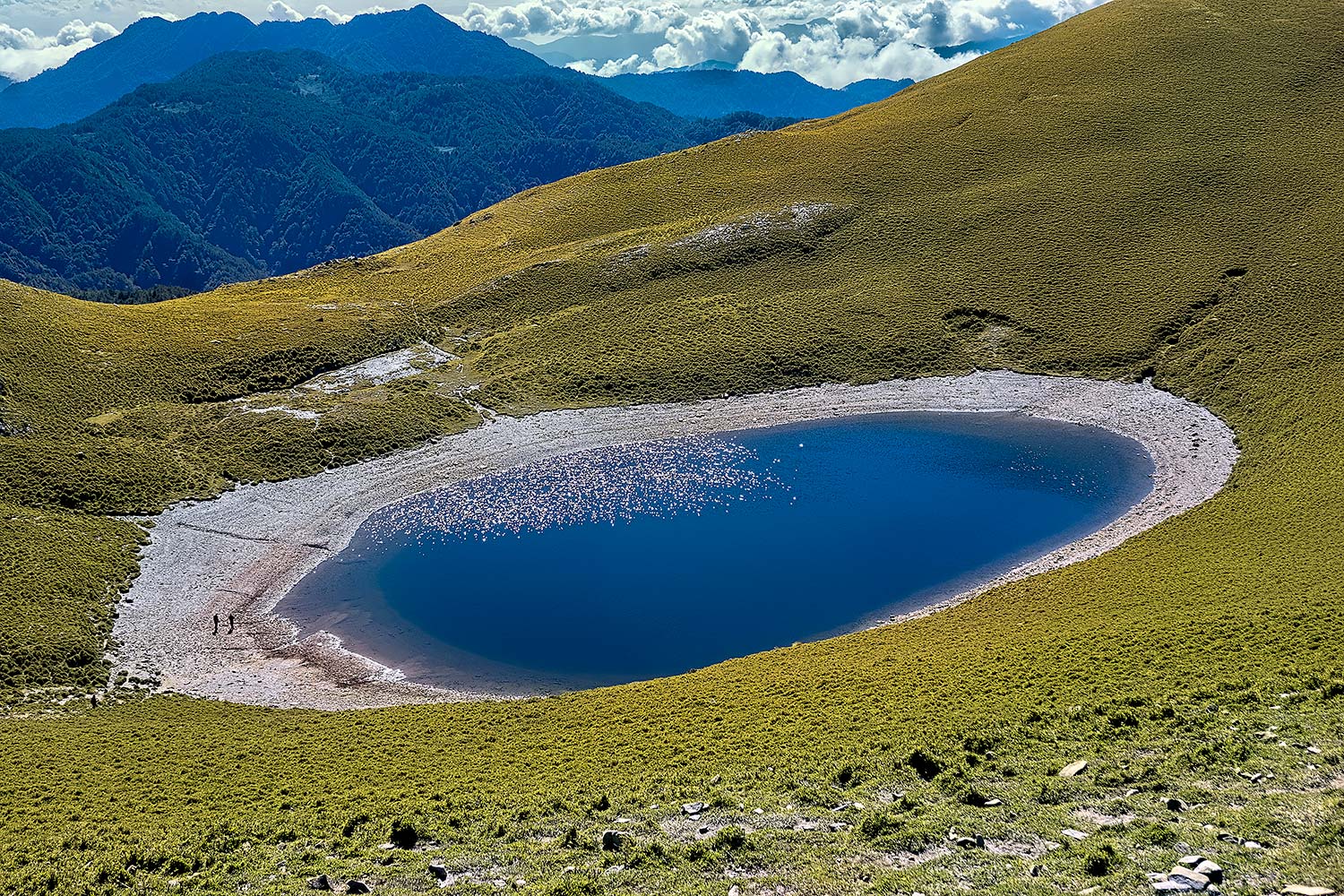
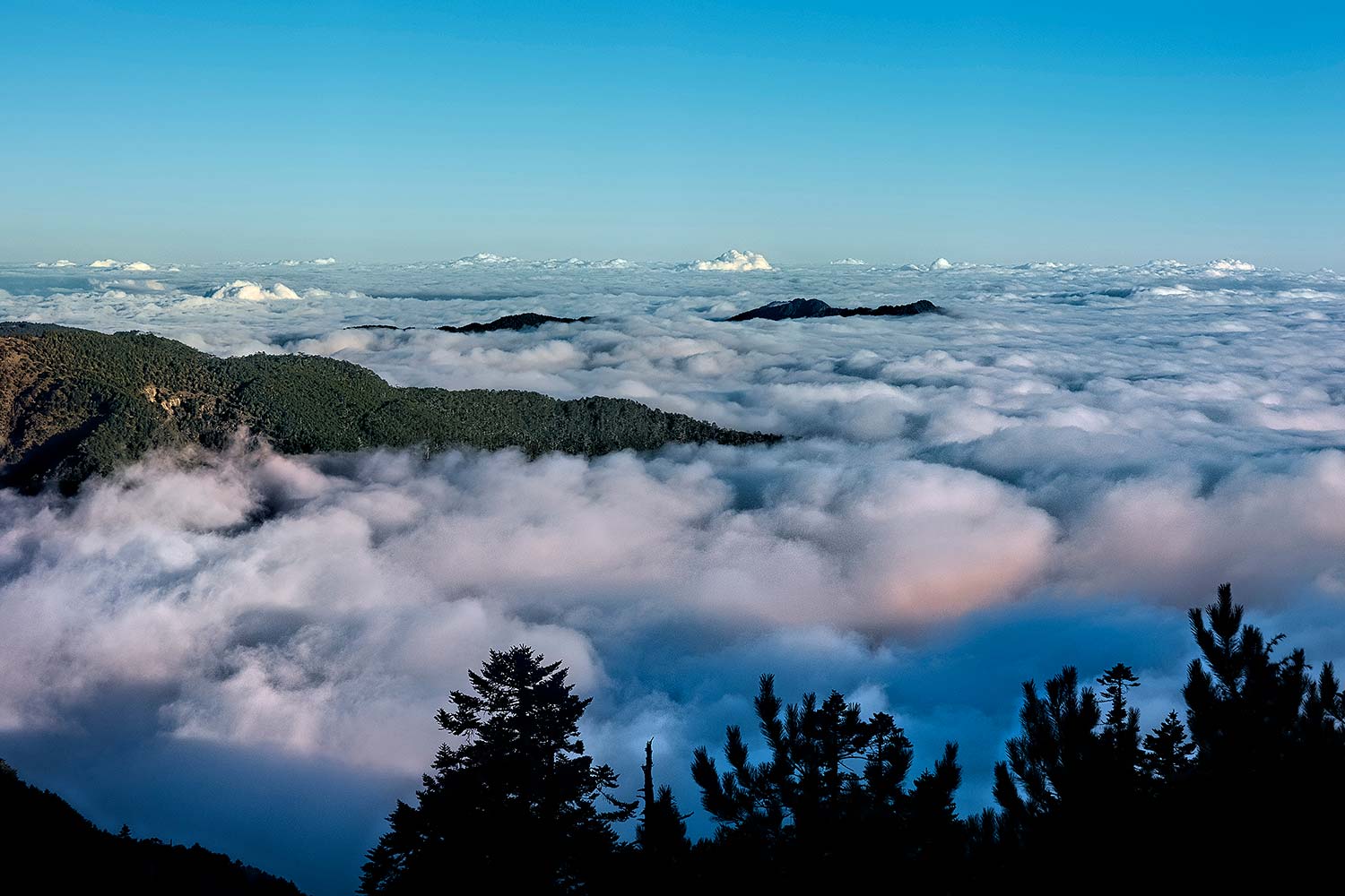
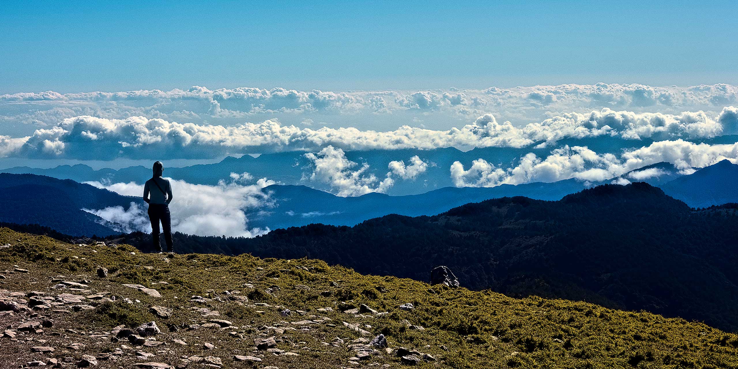
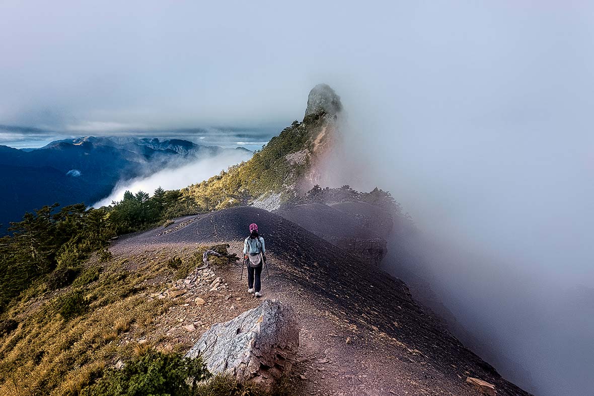
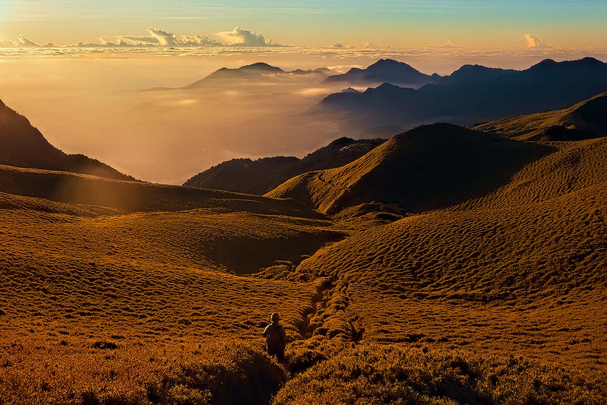
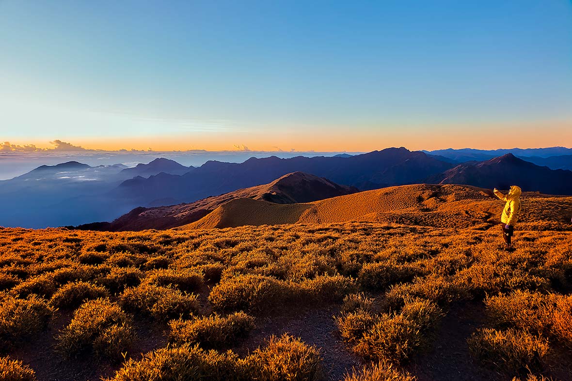
But November is the perfect time to be hiking in Taiwan. We followed a beautiful ridge across Mount Xiangyang and Mount Sancha (both on the top 100 list) to Jiaming Lake, also known as the Angel’s Teardrop, a beautiful high-altitude lake set on a high prairie at 10,000 feet. As elsewhere in the mountains of Taiwan, the cloud bank sat far below us and would come rolling in and rising as the afternoon passed, often making for dramatic sunsets, or descents right out of Chinese landscape paintings, with gnarled hemlock trees perched on the edges of cliffs poking out of the fog.
From Jiaming Lake we made our way further north to the Nenggao Historical Trail. This trail across the Central Range was first used by aboriginals to transport goods from inland villages to the coast. It then became the site of garrisons during the Japanese colonization and WWII. We started a climb up Mount Qilai, yet another peak of the baiyue, which was bathed in golden surroundings with views to the ocean when we summited as the sun rose.
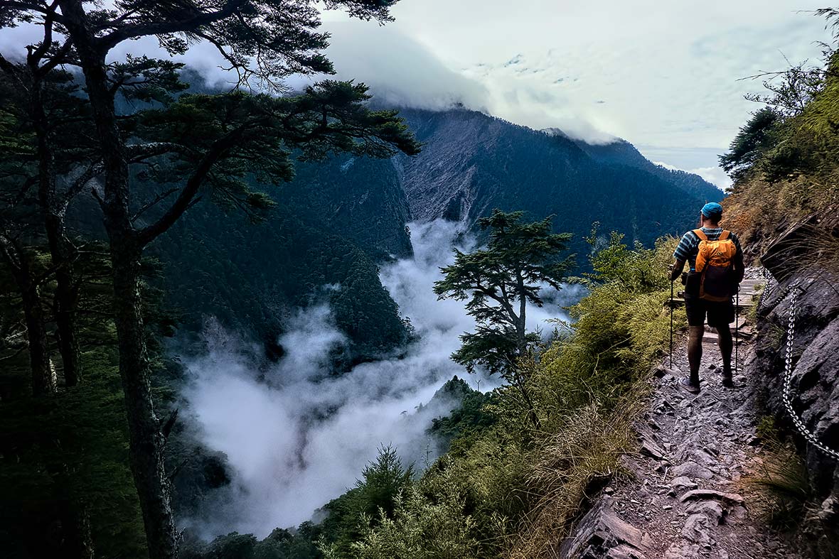
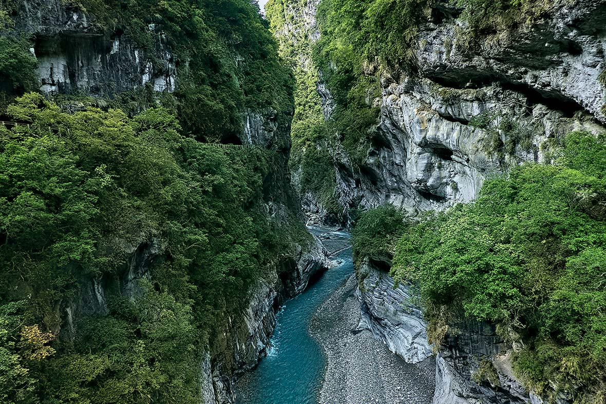
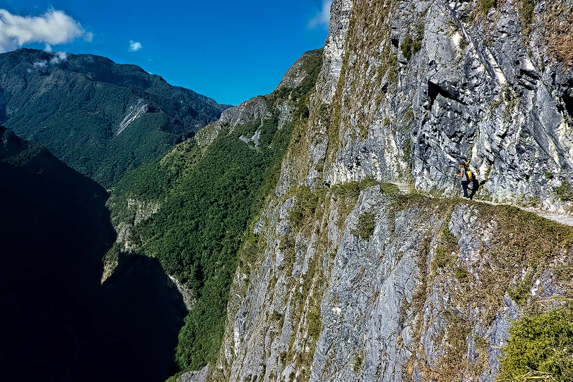
Even the lower mountain trails in Taiwan are spectacular. On the other side of the Nenggao Trail, Taroko National Park is one of the country’s top tourist attractions, featuring a dramatic marble canyon carved by the Liwu River that snakes its way across the park.
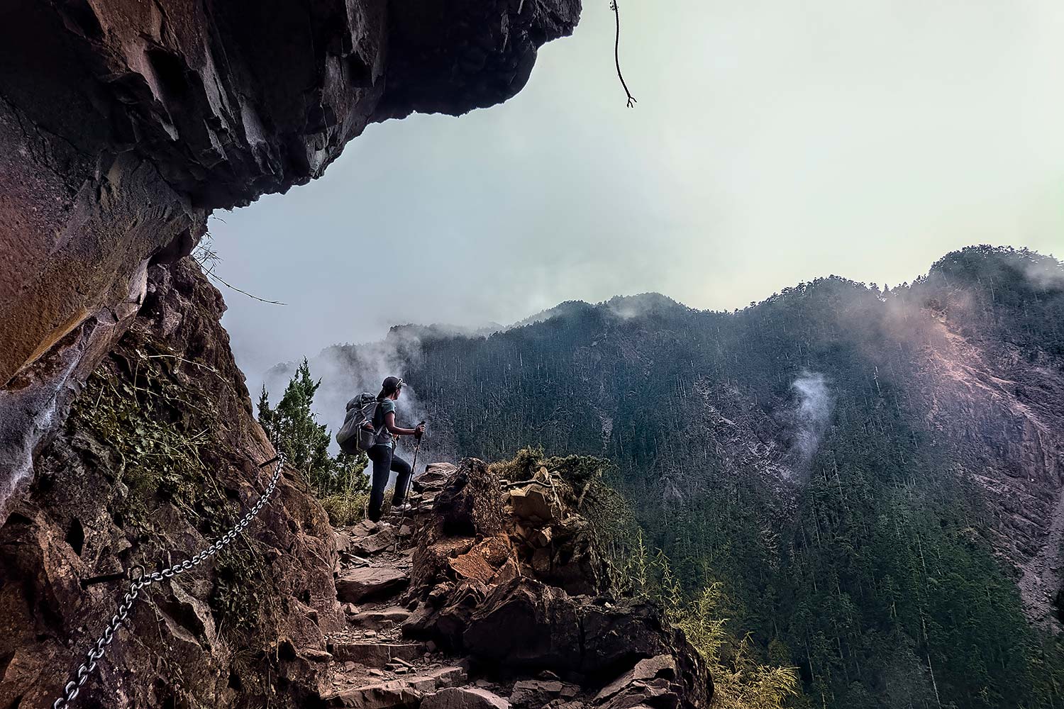
Here we encountered the Zhuilu Old Trail, another path originally made by aboriginals and later Japanese forces to move artillery through the mountains. The route traverses the Liwu on a suspension bridge, then climbs through the forest and emerges miles above the canyon. In its final reaches, it becomes a razor-thin footpath that hugs a canyon wall, with a dramatic unprotected drop of thousands of feet on one side. While a handline has been installed on the rock side for safety, it isn’t the place for those with vertigo, and we made sure to strap our cameras and packs firmly to ourselves as we carefully inched our way across the cliff.
Our final adventure into the terrain above the clouds was on Yushan. This was the only mountain where we met any other foreign tourists, and even mid-week, all the coveted permits for the summit and bed space in the Paiyun cabin were long gone. We’d seen Yushan so clearly from other mountain summits around Taiwan, but our luck ran out, as the mountain was shrouded in dense fog. We left the lodge at 3 am, because embracing the sunrise is an integral part of the climbing experience.
We made our way by headlamp onto the summit ridge, where a route with fixed chains climbed up a rock face to reach its zenith, the highest point of Taiwan. It was around 35°F, but a lot lower due to wind chill, with a brutal gale hammering the summit block. I could barely feel my fingers and was swaddled in down, fleece, and all the other gear I owned.
Yet despite the frigid temps and the fact that we couldn’t see more than ten feet in front of us, I felt an immense satisfaction. We’d climbed some 19 summits in 30 days, seen more of the country than most visitors would, and found the Taiwanese to share our passion for the high country more than most.
I might never knock off all those 100 baiyue, but I knew there were more adventures waiting for us on future visits to this magical mountain isle.