
Chiang Rai province makes up the heart of the Golden Triangle, a world once known for fleeing Kuomintang Chinese soldiers, opium god-kings, and the crossroads to Myanmar and Laos. Today, the pleasant weather and natural surroundings draw travelers the world over, but from the open road there is still something very wild about Thailand’s untamable northeast.
Phu Chi Fah and Phu Chi Dao
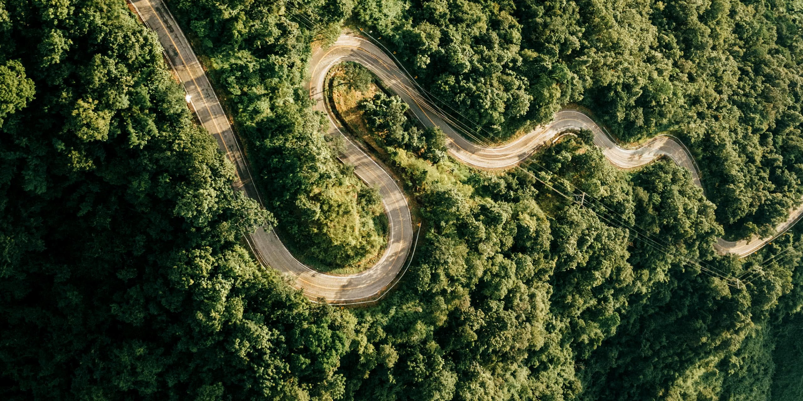
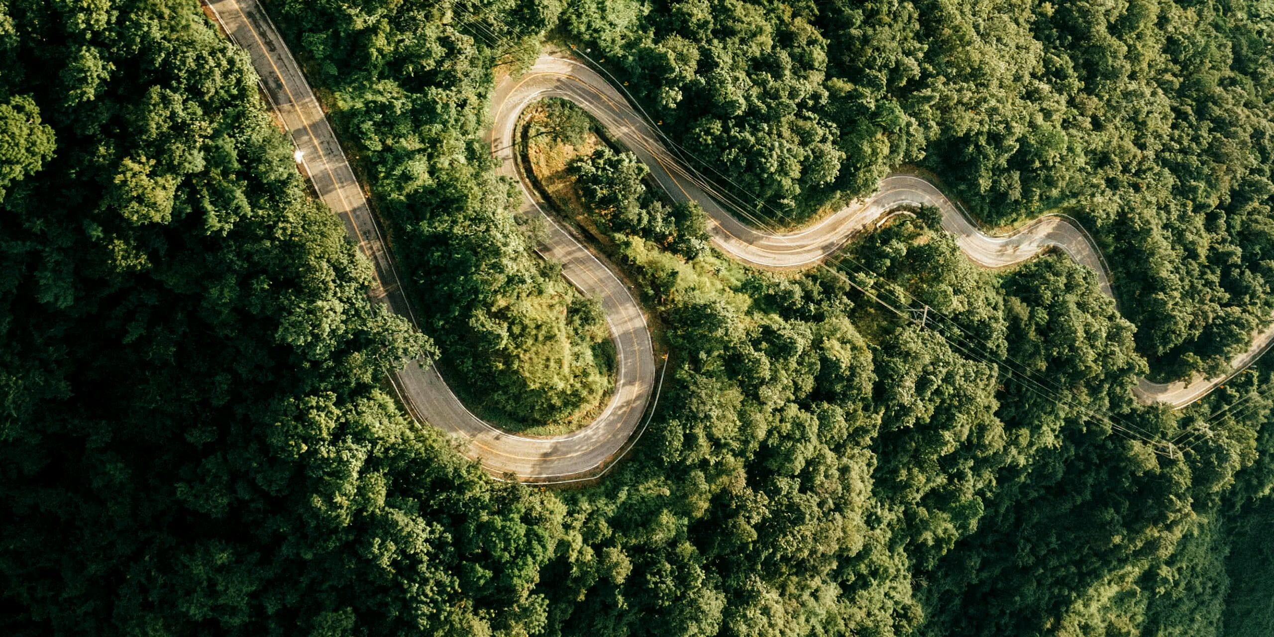
After landing in Chiang Rai, we drove two hours to Phu Chi Fah on the border with Laos and the edge of the Phi Pan Nam mountain range. The road winds from the Chiang Rai lowlands, and gave us a chance to fly our drones and watch some children playing Sepak Takraw, a type of foot-based volleyball that has to be seen to be believed.
Heading out the next day before sunrise for Phu Chi Fah, the drive was safe but not easy. This being the height of the wet season, at times our rental car had trouble with the steep incline and slippery roads. The drive was dark and the hills engulfed in clouds, leaving us with zero visibility. Still, we were able to park and hike to the top of the slippery trail, arriving for sunrise alone — that is, until a noisy, blathering family clamoured to the peace of the mountain view, but that’s just how travel goes these days.
Often, the mountain hills can be seen gently waving above a sea of fog and clouds, but unfortunately it was so cloudy on top of Phu Chi Fah that we couldn’t see anything, making our first destination a bit of a bust. However, back at our homestay, I was able to enjoy watching the clouds moving across the mountains while we ate breakfast — and as our unlucky hotel staff pulled our car out of the mud.
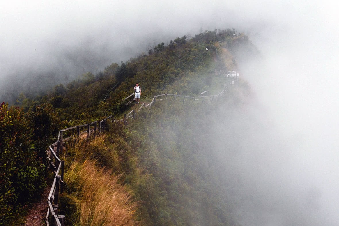
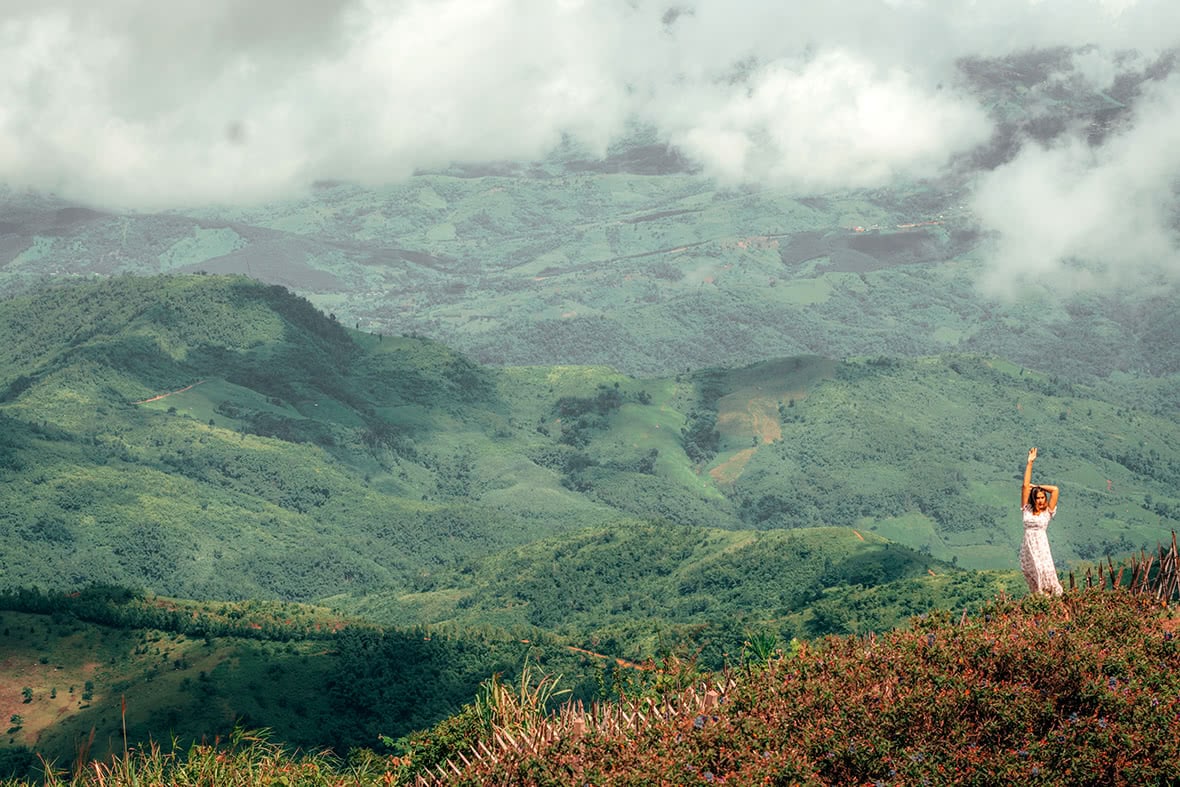
Wasting no time, we headed for Phu Chi Dao after breakfast, only a few kilometers form Phu Chi Fah and hired a local pickup truck to go off-road and hike to the summit, at 1,800 meters. A narrow path leads to the summit of Phu Chi Dao, with sheer drops on all sides and the journey to the top’s spectacular view would have been extremely dangerous without the wooden railing along the way. Here, at least, we were completely alone, the mountain blanketed in thick, swirling clouds. Every once in a while the clouds would clear enough for us to see Laos for a few moments before the mountain mists would hide it away again.
Doi Pha Thang
Following the green hills north, we made our way to Doi Pha Thang, 30 minutes away. Stopping for coffee along the way, we saw signs that said “No New Faces” which we assumed meant that strangers weren’t wanted due to Covid. That said, the whole region is going to need to adapt to “new faces” soon, as Thailand plans to open up to 46 countries by the month’s end.
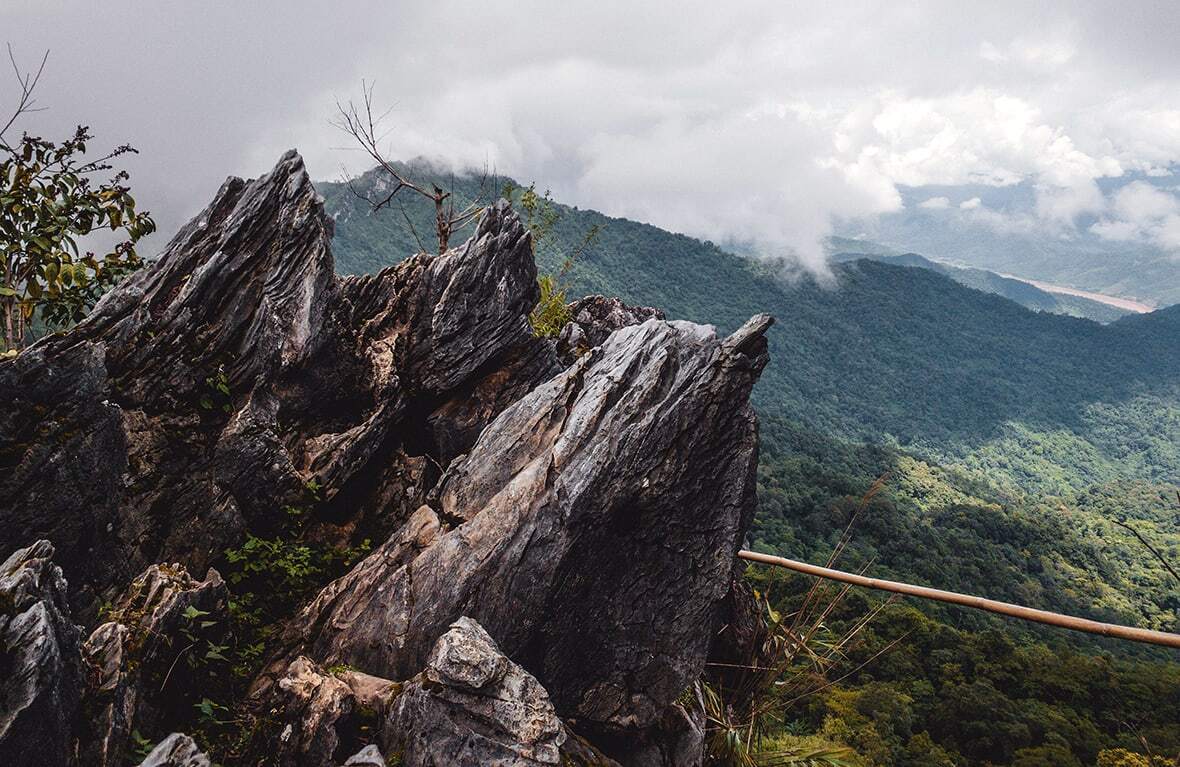
Doi Pha Thang didn’t have the steep approach that the other two mountains had, but the views from up top — once again of Laos — were extraordinary. It was here that we got our first view of the Mekong river — the largest in mainland southeast Asia and flowing from the meltwaters of the Himalayas in China to the delta in Vietnam. More than 60 million people in Southeast Asia rely on this river for food, and it is responsible for some of the most amazing ecologies on the continent. After lunch we set off on the long drive up the Mekong and toward the Golden Triangle.
Chiang Khong and Doi Sa Ngo
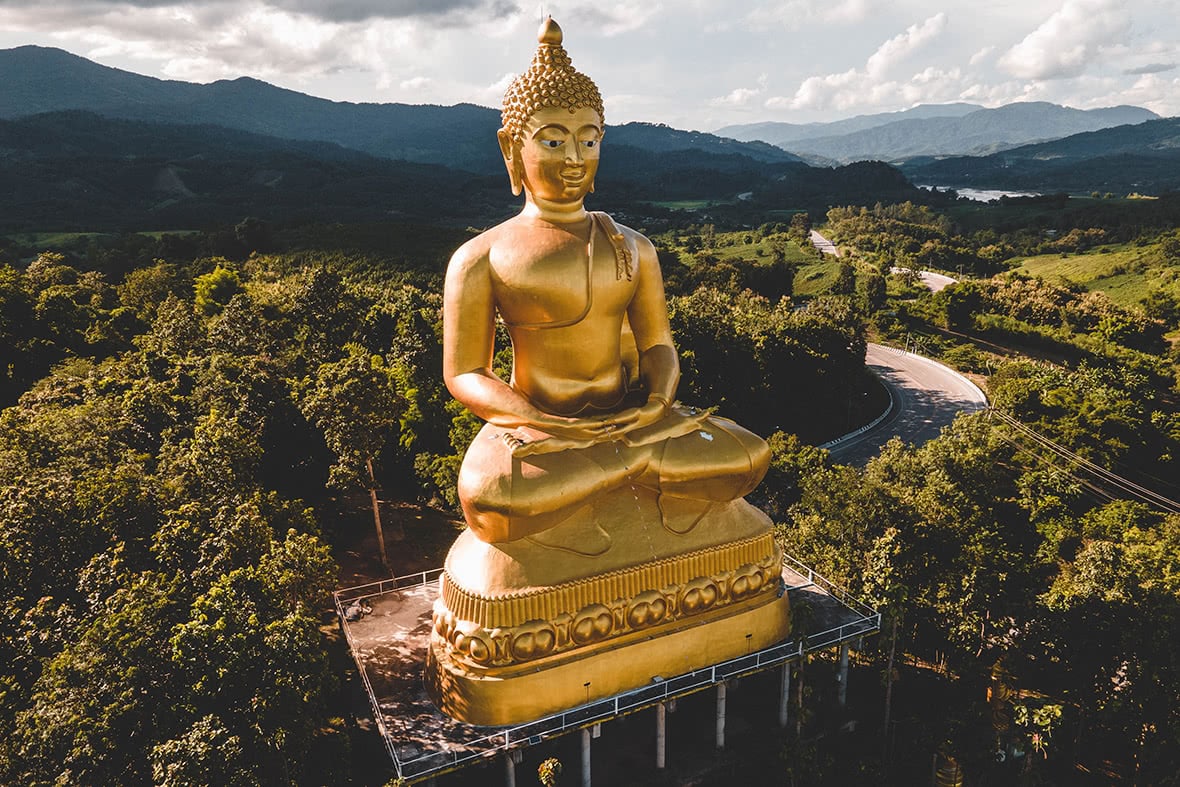
We drove along the Mekong for about an hour with views across the river near Chiang Khong, a well-known Mekong town and an important border crossing into Huay Xai into Laos. Driving from Chiang Khong, we came to a large golden Buddha statue at Buddha Park Phusawan that made for excellent drone video, and then turned our attention to Doi Sa Ngo which faces the Golden Triangle itself.
After driving for two hours we followed a dirt farmers’ road to a mountain viewpoint popular with local Thais who camp there. The view is, of course, beautiful, and the sight of three nations meeting at the Mekong and Ruak rivers is breathtaking, but here the locals like to drink, sing, and play guitars, which somewhat ruins the majesty of the scenery.
Burmese Border
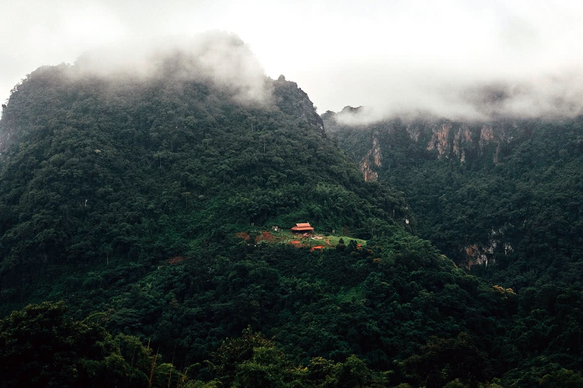
After a detour to Mae Sai to spend the night, at 8am we set off for Doi Pha Hee; the road was a winding, enjoyable maze complete with military checkpoints every few minutes as the road is only meters away from the restive Myanmar border — at this point eight months into a violent coup. In fact, on Google Maps Myanmar’s border leaks into the middle of the road. Much to our chagrin, Doi Pha Hee was closed to outsiders due to Covid, so we had to make due with views from the village. More specifically, the views from Bear House Cafe turned out to be a highlight of the journey.
Slightly discouraged we continued on along the army road, hugging the border with Myanmar, stopping only briefly at a coffee shop that appeared to be run by the military at the Chang Moob Military Outpost, complete with a machine gun propped up against the wall behind my barista.
Chiang Rai and Mae Salong
Our destination for the night was the tea plantations of Mae Salong, but we detoured into Chiang Rai city to see the Blue Temple and the large white statue of Guanyin at Wat Hua Pla Kang. The rich sapphire hues of the Blue Temple, or Wat Rong Suea Ten, make a welcome change from the whites and golds of most Thai temples — adding a strange, mystic quality — and the temple itself means “Temple of the Dancing Tiger”. The Guanyin, as the name might suggest, is actually done in a Chinese style, evident by the dragons at the foot of the statue itself.
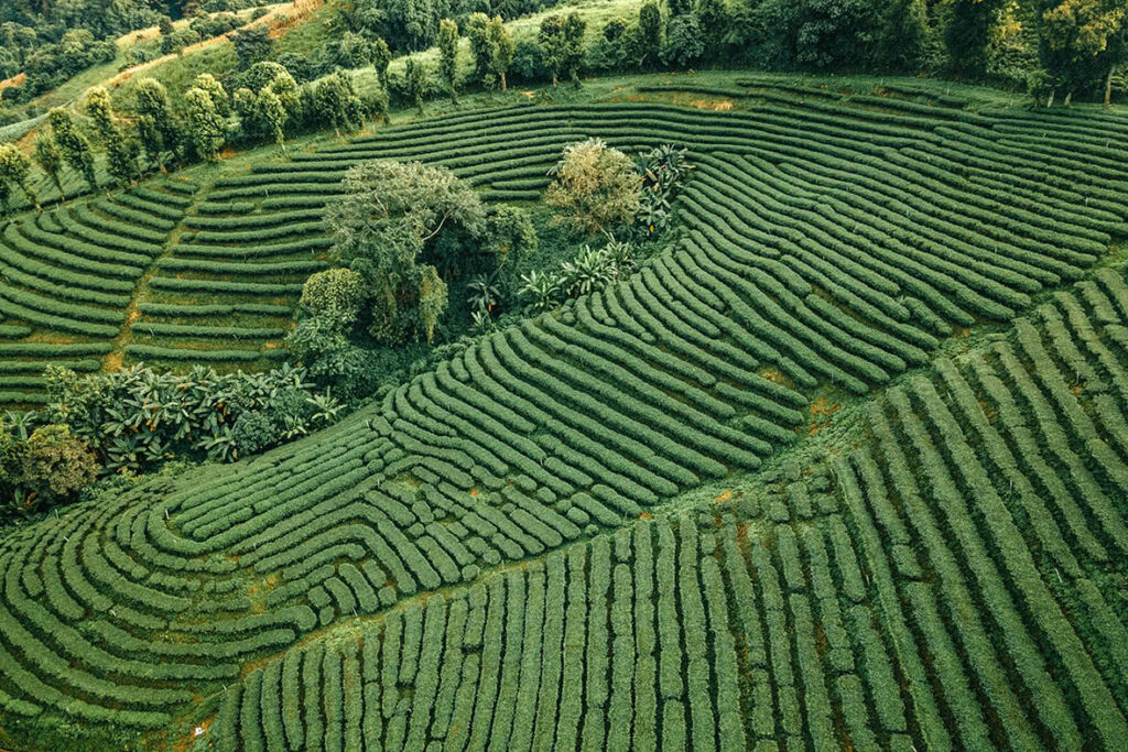
The final destination is that of Mae Salong, where we stayed at the 101 Green View Tea Plantation, with some of the most amazing views directly from our rooms. Though today famed for its tea fields, it was once known for the retreating republican soldiers of China who would then set up a fearful drug empire.


Next day we drove around Mae Salong and then back to Chiang Rai to fly home, but not before seeing one of Chiang Rai’s most famous sites: The White Temple, or Wat Rong Khun. Not actually a real temple, this shining white structure features irreverent imagery — including Hello Kitty, Pinhead from Hellraiser, and a Predator. Despite its strange interior the fascinating architecture has made it one of the most recognizable symbols of Chiang Rai.
Prior to the current military troubles in Myanmar, this region was famed the world over for its trade in opium and the drug lords running their own private armies. Today, the opium has been replaced with cafes and the drug lords with tourists, but the region retains its mystical, forbidden reputation — the land between the mountains and the Mekong.