
There is remote and then there is really remote. And the latter does a fair job of describing Bartang Valley, one of the highlights of the fabled Pamir Highway.
For many travelers, hitting the route, better known as “The Roof of the World,” is an experience of a lifetime.


Part of the fabled ancient Silk Road, the route traverses some 1200 kilometers between Osh, Kyrgyzstan, and Dushanbe, the Tajik capital.
The road was originally made during the epic Great Game when the British and Russian empires fought for control of Central Asia, and today is considered one of the top adventure travel destinations in the world.
Despite the rugged travel, my wife and I love crossing the Pamirs. And on our most recent trip, we decided to take the even more “road less traveled,” getting off the M41 (as the main Pamir Highway is numbered) and across the sublimely wild, isolated, and stunningly beautiful Bartang Valley.
The Bartang River is a savage and raging affair, flowing through narrow canyons under towering walls and jagged peaks, snaking its way across the heart of Tajik National Park. The river is aptly named, as Bartang means “narrow passage,” and before the 20th century, fords, platforms, and ladders had to be created along the treacherous dirt track to get pack animals through. While there is a “road,” today, it’s 4WD, hair raising, and the entire valley gets cut off from the rest of Tajikistan each winter. Needless to say, there are no airports here.
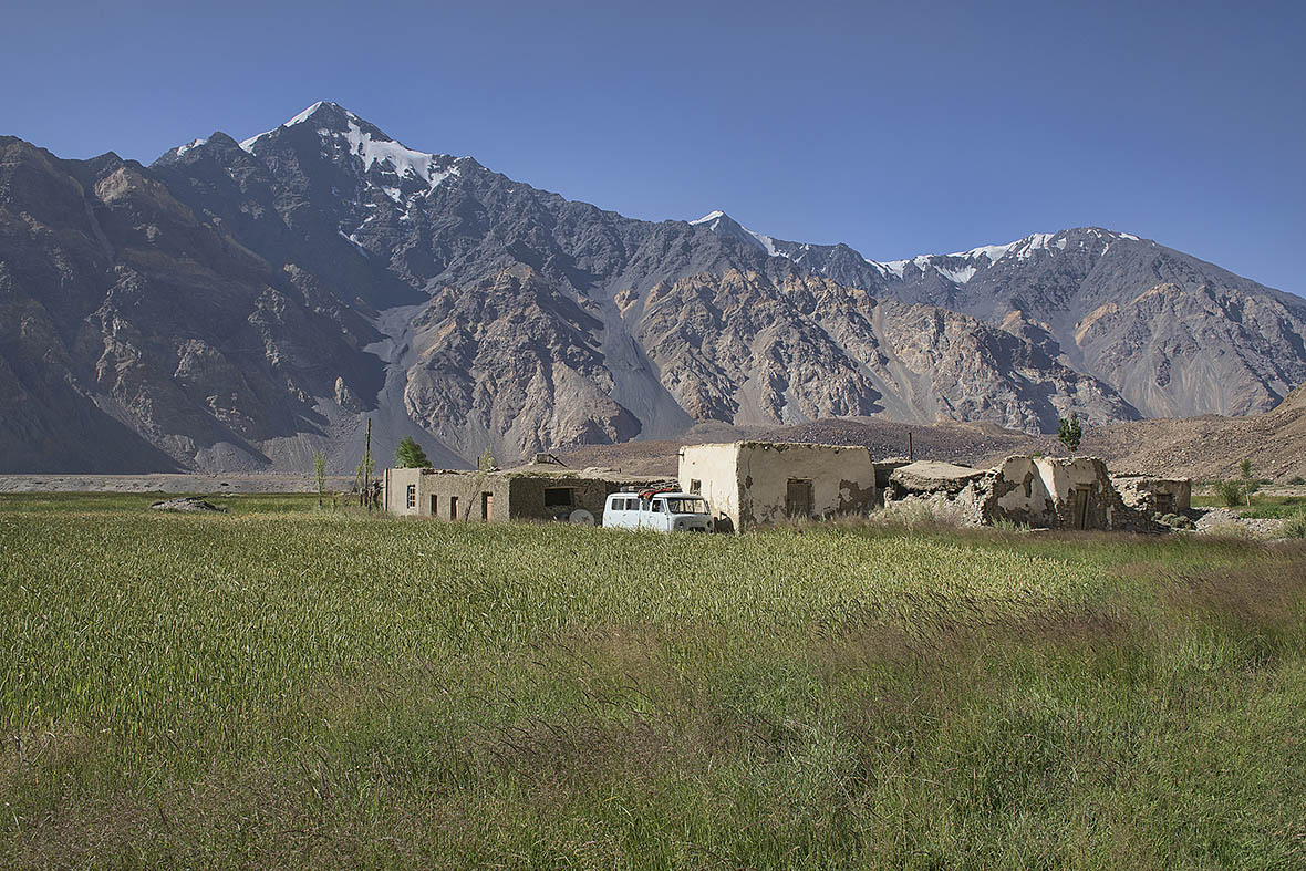
Our first stop along the route was in the hamlet of Jizeu, accessible on foot via a rickety wooden suspension bridge and then several hours of walking. One could do a day hike here, but the picturesque village of adobe huts settled near a chain of lakes is well worth spending a night or two, and a dozen of the families here now run comfortable homestays.
Our host here, Gulsha, dished up large servings of hearty meat stew along with fresh warm nan flatbread, accompanied by steaming mugs of tea. While tourism is making inroads here, it’s still just a trickle of intrepid travelers, and most days Gulsha said she’d spend sitting outside in front of her cabbage patch, knitting woven bags to send to the market in Khorog to sell, surrounded by the vast jagged peaks that encircle the village.
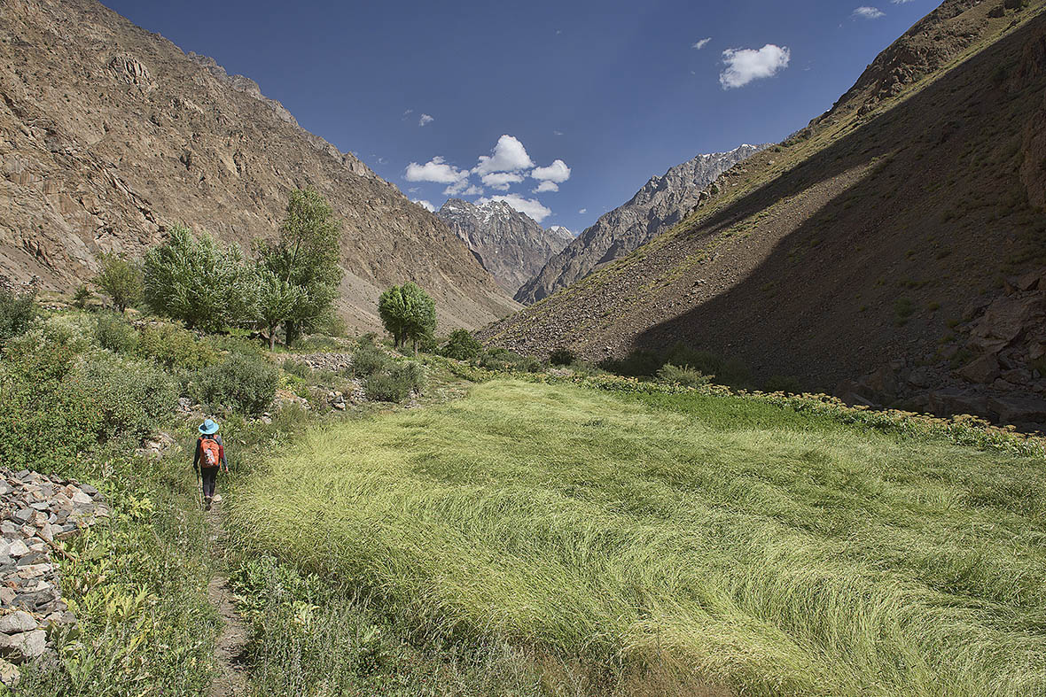
Further on from Jizeu, the Bartang becomes more violent, the river raging and frothing, and the road becoming a rutted track that saw us traverse unstable boulder-strewn slopes, claw up rocky passes, and sometimes come down to hug the river, only a tire’s-width from the water. We crawled along and finally reached the village of Pasor, where locals mark their calendars not by dates and numbers but by parts of the body. Starting with the toes and moving up to the head, each body part is associated with a seasonal occurrence.
Spring includes moments such as the lake ice first breaking, or the first flowers blooming. The season finishes at the head, and then you count back down to the toes. This age-old method has told farmers and herders when they plow or reap their harvest when to take animals to graze, and when to move camp for the winter.
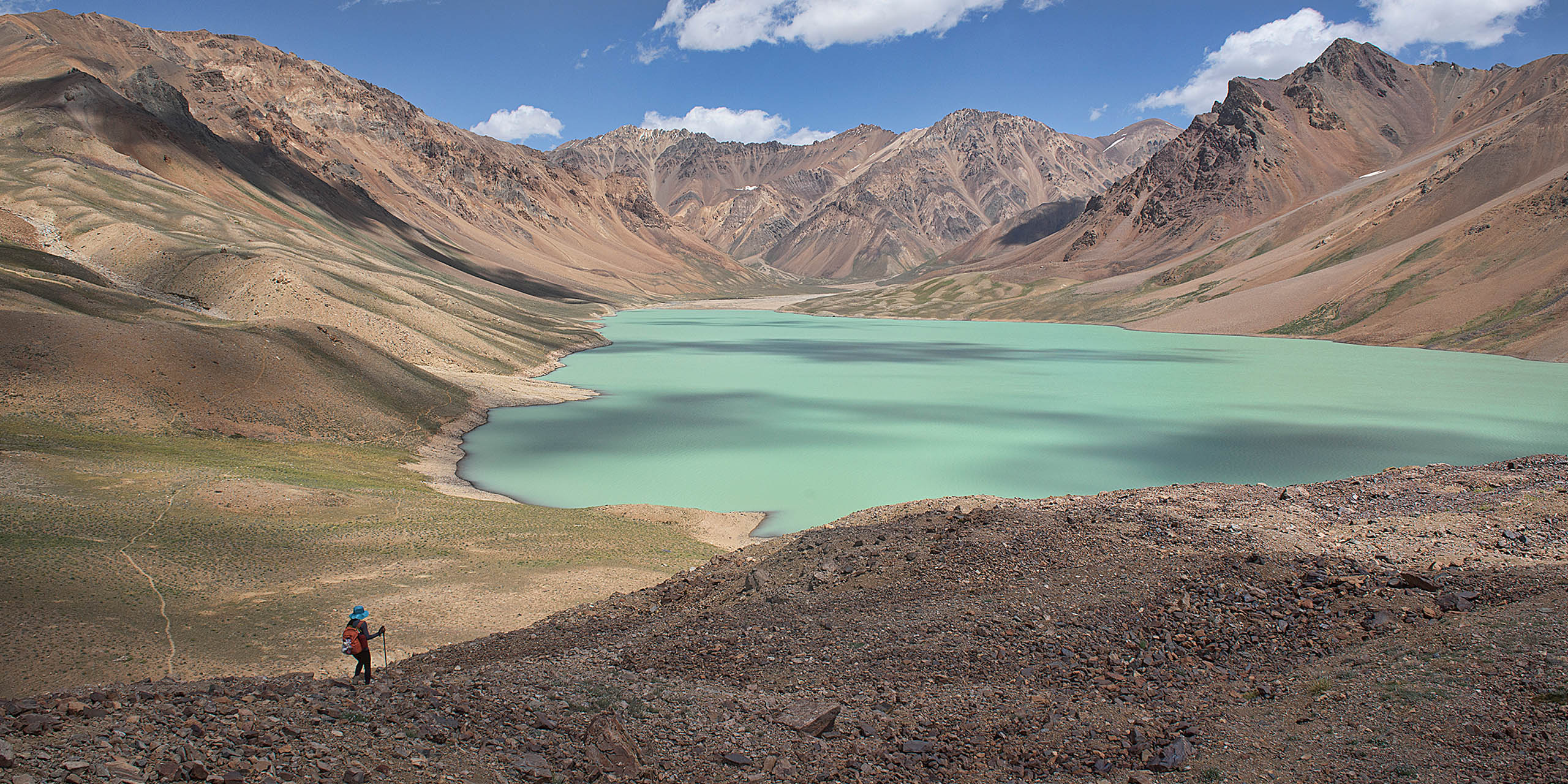
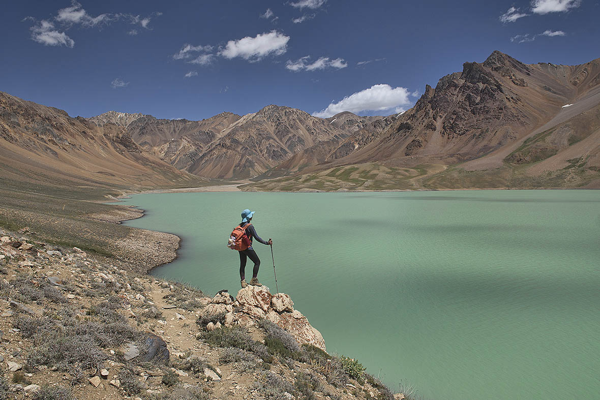
We packed up our backpacks here, hired the services of a muleteer, and headed out for several days to explore the Khafrazdara Valley, which might be the most gorgeous place in all of Tajikistan. The valley is set up at 4,300 meters (14,190 feet) and is home to Khafrazdara Lake, a stunning emerald gem, surrounded by parched mountains painted in kaleidoscopic colors.
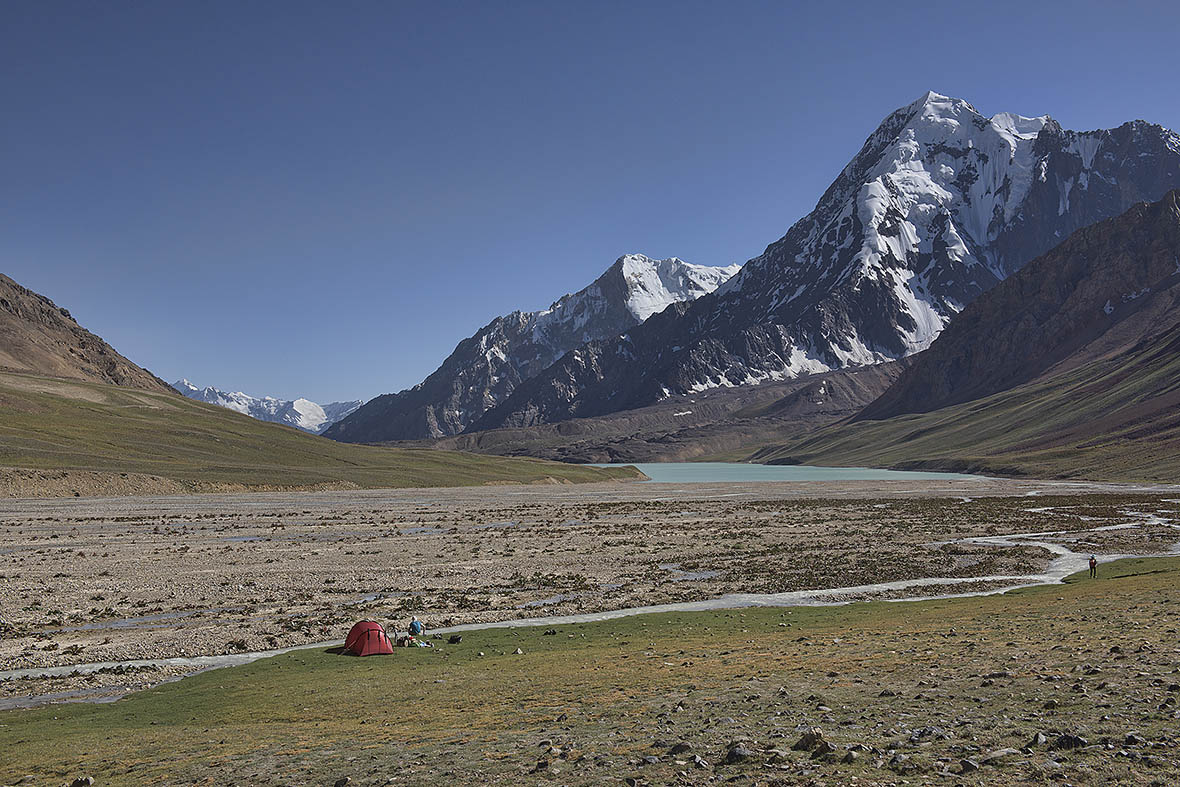
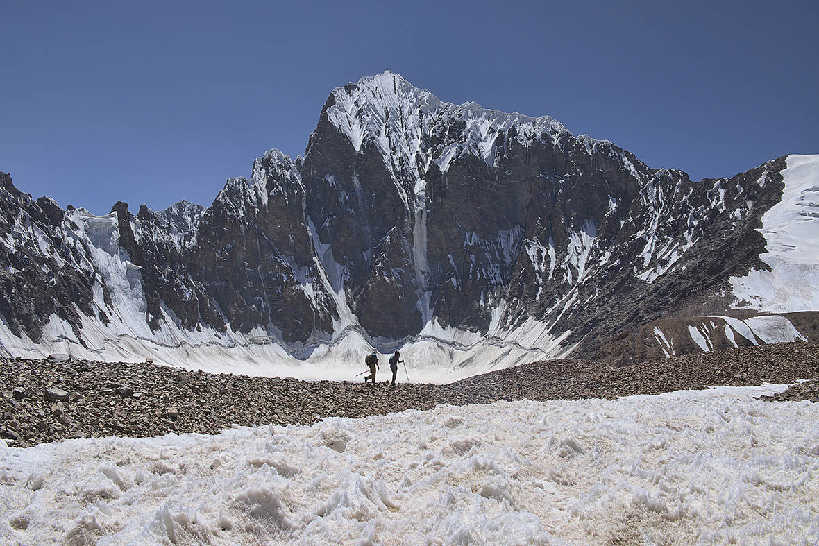
From here, the trail climbed higher, eventually disappearing, then turning into lateral moraine. In front of us, the moraine gave way to the head of the Grumm-Grzhimaylo, glacier, named after a Russian entomologist, Gregory Grumm-Grzhimaylo, who explored the Fedchenko (a glacier system covering some 700 square kilometers and the world’s longest glacier outside of the polar regions) and its tongue glaciers during an expedition to the Pamirs in 1884. He collected 12,000 insect specimens during this journey, thirty of which were new to science. The majority of wildlife we’ve seen has been mosquitoes, along with maybe fifty marmots, but then unlike Grumm-Grzhimaylo, most of our attention had been riveted on the outstanding scenery.
Winter here would bring high chances of spotting the elusive Marco Polo sheep or snow leopards that frequent the high Pamirs, with their fresh tracks in the snowmaking for easy scouting, but that would entail temperatures plummeting into the minus forties, not to mention having to remain in the Bartang Valley until the spring thaw, and after hearing our mule driver Aznov tell us stories of survival, where locals rely on subsistence-level herding and farming for meat and enough food, and stacking their homes with carpets, rugs, yak blankets, and enough firewood to manage the brutal cold, we decide our summer foray is about as wild as it is going to get.
The route for non-mountaineers without technical equipment ends high up at the edge of the Grumm-Grzhimaylo glacier, in a wild mountain cirque, surrounded by a crumbling landscape of brittle rock and snow. A passage by Galen Rowell, the renowned outdoor photographer and mountaineer come to mind: as we feel we are in the “throne room of the mountain gods”.
We descend back down to the beautiful Khafrazdara again, where a few herders are grazing their yaks. Above here, it’s too cold and barren for the animals, and with such few tourists in this remote spot, one sees little evidence of any human footprint. In the wildest spots in the Himalayas, one still comes across a candy wrapper or some sort of litter here and there, and in Europe or the U.S., if there isn’t trash, then there is still a man-made trail, but out here it is just pure wilderness.
Descending back down to Pasor we’re stunned to see that the river we’d crossed on the way up has become a raging torrent, and while we find a rock ledge on one side strong enough to hold us as we sidle across, Aznov has to navigate the mules loaded with all our luggage through the rushing current. When we’d started the hike up out of Pasor, I’d asked him what he could tell us about the route we were following, and he smiled, revealing a mouth full of gold teeth and said, “Eez beautiful.” And while this Pamiri version might be a bit rough around the edges, we have to agree he was right.