
The beast keeps rumbling incessantly, spewing smoke less than two kilometers away from me. From this vantage point, high above a dusty moonscape of extinguished lava flows, the air feels thick with fine dust, and the crater sends plumes of smoke straight into the sky before me.
We may have foolishly come too close, but such a force of nature is too rare a sight not to brave the risk. The best way to describe the soundtrack to the apocalyptic scene unfolding before us is a roaring jet engine that whirs, then drops to a rumble, then whirs again. Welcome to Gunung Dukono, one of Indonesia‘s most active and least visited volcanoes, which has been erupting, remarkably, almost continuously since 1933.
Standing 1,229 meters tall, Gunung Dukono’s smoky cone looms over the town of Tobelo on the northern side of Halmahera’s westernmost peninsula, often blanketing the sky above in ash-gray tones. This offbeat island, shaped like a crooked letter X, is one of the northernmost and largest in the remote Maluku archipelago, a rugged playground for adventurous travelers willing to push into Indonesia’s lesser-known reaches.
“Let’s see how the conditions look tomorrow morning, and we’ll decide if it’s safe to climb,” says our guide.
The images and videos of Dukono’s caldera, with towering plumes of ash rising from deep within the mountain, had already convinced me. I was determined to tick off this once-in-a-lifetime hike. The trek would take us across an otherworldly landscape of ancient lava flows and volcanic sand plains, with a final chance, weather permitting, to peer inside a dangerously active, hissing, smoke-belching volcano.
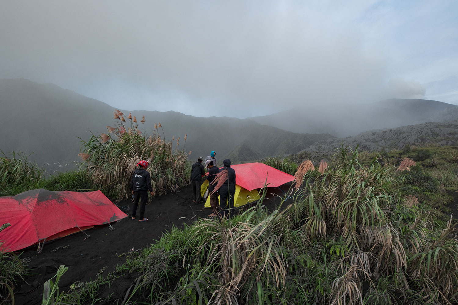
“Provided there’s no smoke coming out, if the volcano doesn’t rumble, it’s potentially dangerous,” explains a second local guide, who joined for added safety. “It can spit hot stones the size of footballs into the sky,” he adds as we unpack gear and set up camp for the night.
As if to underline the warning, the volcano keeps “talking” in the background, steady bursts of explosions that make me imagine a battlefield. Some in our group start sneezing as ash drifts through the air, settling on clothes, bags, and supplies.
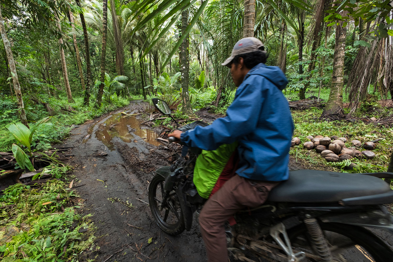
Dukono’s original trail begins at Mamuya village, where a volcanology office monitors the mountain’s activity. But we’re told it’s now safer to take a better-maintained second trail from Roku village. From there, it’s a 7.5 km hike that fit hikers can complete in about five hours, the last stretch crossing the flat, eerie moonscape of lava fields surrounding the restless volcano.
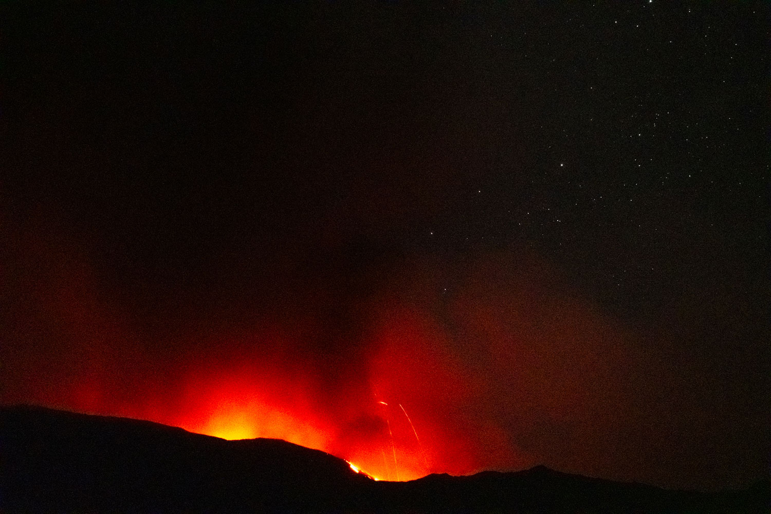
After the guides secure poles and a tarp over our tents, we settle in with our supplies. I sip instant cappuccino while staring at the silhouette of the caldera, glowing red like embers against the pitch-black night, caught between concern and hope that the weather will clear by morning.
I sleep soundly, occasionally waking to what I assume is heavy rain. “Forget it,” I think, drifting in and out of sleep, “be content with seeing it from a distance.” When I step out of my tent at dawn, I realize the “rain” was something else entirely: a layer of dark ash has piled a couple of inches over the tarp. Dukono has been spitting on us all night.
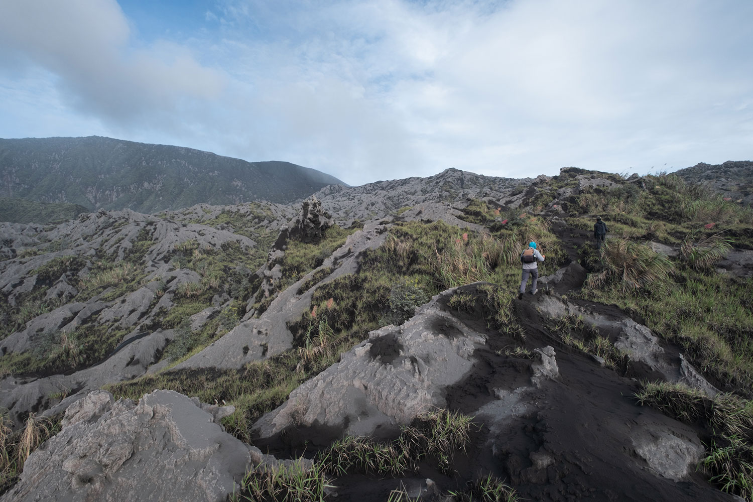
With the sun up, we’re rewarded with sweeping views of Gunung Gogodom, Gunung Bale-Bale, and the islands off Tobelo’s coast fading into the distance. The 8 a.m. ferry to Morotai Island looks like a toy drifting across a misty blue horizon. Dukono, for the moment, is silent.
“I think you shouldn’t go,” one of the guides says, frowning.
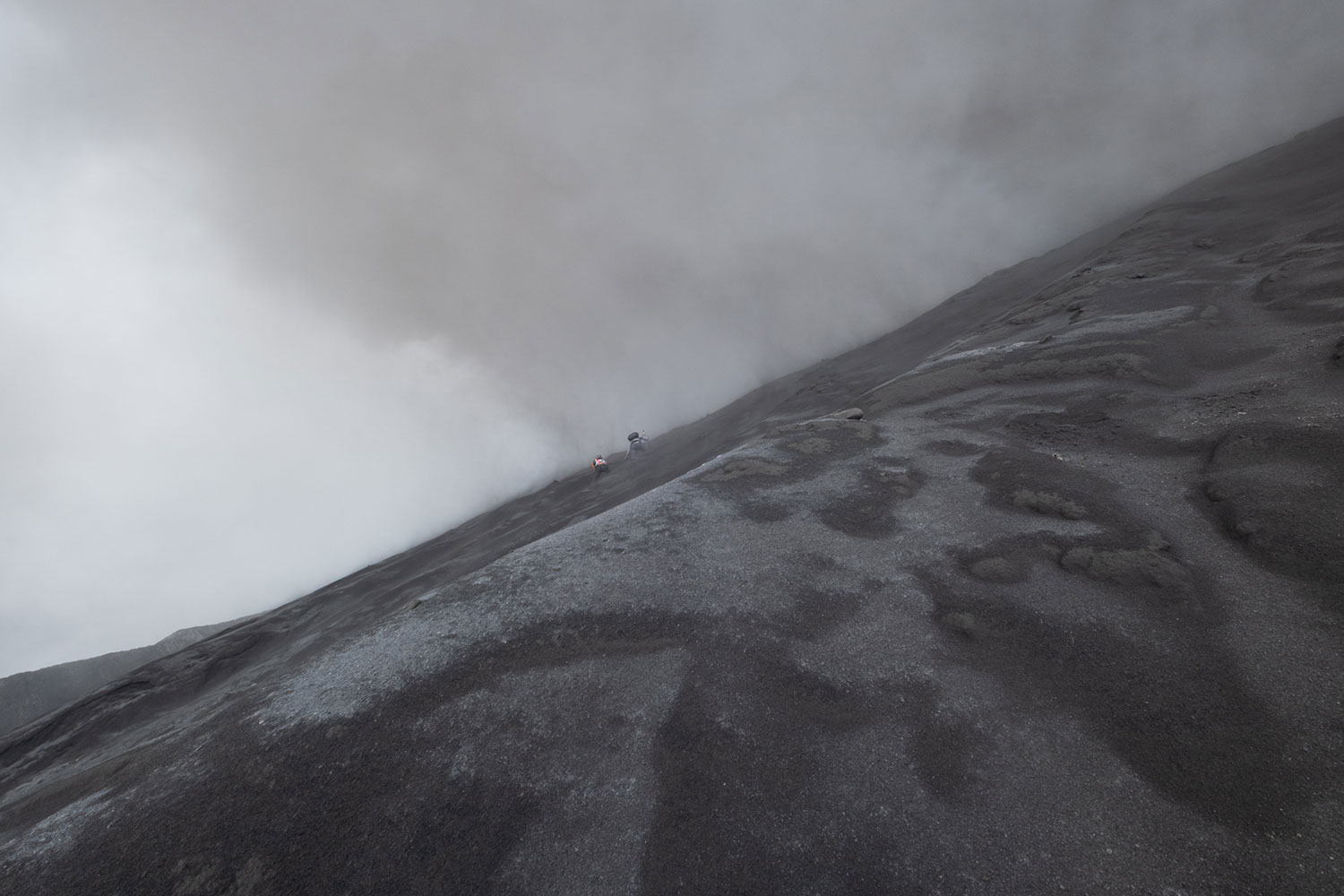
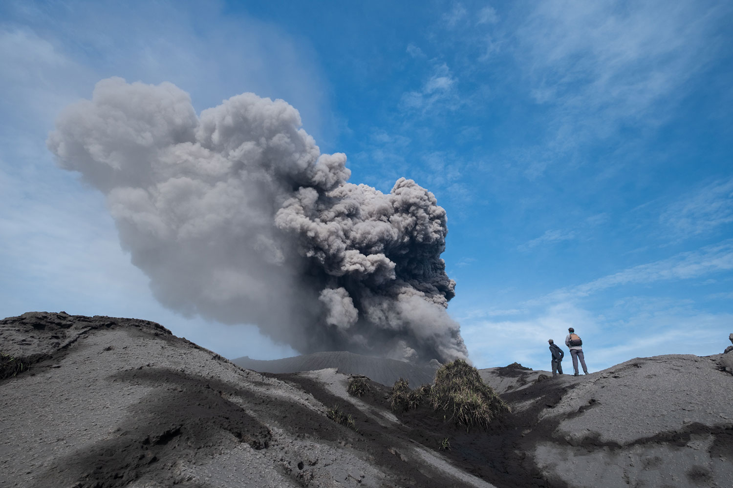
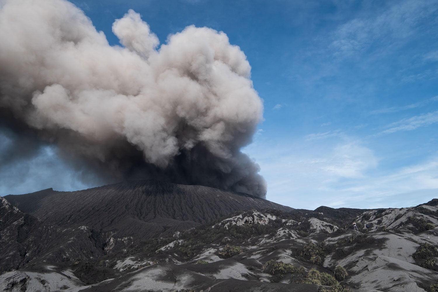
We wait for half an hour, watching intermittent plumes of ash rise from a volcano I almost wish would roar again. The good news is that no stones are flying out, so eventually we get the go-ahead. We follow our guide across snaking crevasses and lava flows, a gray landscape he prefers to navigate barefoot to keep sand out of his shoes.
I kneel to touch some of the rocks ejected the night before, like volcanic baby teeth, and they’re still warm. A shiver runs through me. Within fifteen minutes, we reach the cone and begin the climb.
“We are going to do exactly this, and you have to promise me you’ll follow,” the guide says. “When we reach the rim, hold on tight, look inside, and we stay less than five minutes. Then we go down. Fast.” He makes sure my wife agrees.
The climb is brutal, scrambling up loose sand that slides us back with every step. Just before we reach the rim, Dukono makes its move. A stone shoots out of the caldera and arcs overhead. We instinctively cluster together. For a second, it looks like it’s coming straight at us, before shifting course and crashing somewhere below.
Now or never.
With help, we scramble the final stretch. I feel the rim beneath my fingers and grip hard. At that exact moment, the silent mountain starts hissing again. We look down into its molten core, a brief, almost unreal glimpse. Then I feel a tug, turn back, and see our guide already heading down.
I don’t stop until we’ve put distance between ourselves and the crater. When I finally turn around, Dukono is alive again, endlessly spewing smoke, waiting, perhaps, for its next eruption.